Friday, October 30, 2015

St Bathans

The small town of St Bathans in Otago New Zealand is off the beaten track but very well worthwhile making the detour to spend several hours there.

Gold was discovered in 1863 and St Bathans began as the boom town known as Dunstan Creek. The Irishman Peyman and his Australian colleagues found good gold in the creek, and within one week, the rush was on. 200-300 miners were busy at the foot of Mt. St Bathans. There were 14 hotels by 1865!

The University of Otago has a very good account of how the gold got there.

Typical off most gold mining towns; springing up quickly were banks, hotels, shops and stables. By the 1870s the town was at its height with four hotels, a bakery, draper, boot-maker, butcher, newsagent, blacksmiths and general stores. What we see today are the remains of this once thriving town of about a 1000 at its peak.

Main Street, St Bathans


The Gold Office

Water power was used to sluice away the gold bearing quartz gravel.

A fine example of the monitors used in alluvial gold mining.

Innovative use of a smaller monitor.

The Blue Lake
Mining gold here resulted in a large hole which filled up with water which took on a blue colour. 

There is a good walking track around the lake and some interesting geological formations can be seen which give this area a very distinctive appearance.


Plant material buried in quartz gravels formed lignite measures during burial.

Dotted around the lake are the rusting remains of machinery and pipes used to bring water in for the sluicing operations.


After a good look around it was time to head back to town for some refreshments
.


The bar in the Vulcan.

The Vulcan is reputed to be haunted but we didn't stay the night night to see if the ghost made an appearance. I highly recommend the Devonshire teas if you can't stay.

Suitably refreshed it was then time to explore the rest of St Bathans.


The Post Office from the loop track.


"The former St Bathans Post Office was built in 1909, replacing an earlier post office at the site. The post office was closed in 1937. From then it has had a varied life including being used temporarily as a school and private residence. 

It is a grand two-storied timber building that dominates the streetscape of the once-booming gold mining town of St Bathans. One of four heritage buildings managed by DOC in the village, the post office is important to both the local and wider Central Otago community. St Bathans is a key side-trip for tourists, including those from the Otago Central Rail Trail. " 


St Patricks Catholic Church

The graveyard is on a sloping behind the church

The remains of the school.

I thoroughly recommend that if you are traveling the Otago Rail trail  or travelling from Alexandra through the Pigroot (SH85) to Palmerston, a detour to St Bathans is a "must do".

Monday, July 13, 2015

Moeraki Day 2

The second day of our weekend at Moeraki again started with an attempt to catch the sunrise just after 0800 hrs. However the sunrise today was disappointing and no photos worthy of including here were taken.

Day 1

First stop was high above Moeraki with some spectacular views of the village and coast to the north.

Moeraki - a fishing village.

The Boulders tearooms are to the right of the tree in the centre.

Looking north towards Kakanui and Oamaru.

The reconstructed road about to be opened.

On the road towards the lighthouse there are two turnoffs to small settlements - The Kaik. They are composed of small holiday houses or cribs (as we are south of the Waitaki here.)


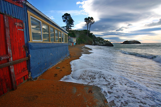
The following photos show how close to the sea some of the cribs are and how vulnerable they are to coastal erosion.


A moment later.


There was a large southerly swell coming up from the deep south which lead to some spectacular wave action.


A small reef a little offshore produced different breaking waves each time. Dozens of photos were taken - these two being among the better ones.


Behind one of the settlements was another beach which enthralled us with the wave action. The dying southerly still whipped up some good activity worthy of the time to get that "perfect shot".


The incoming wave was half the height before this happened.The out-wash from the previous wave produced this build up and brief standing wave before it all came crashing down. The next photo shows what happened a few seconds later.


As the weather was moderating, the local fisherman started to venture out to catch some of the blue cod Moearki is famous for.


Tuesday, June 16, 2015

Moeraki Day 1


We recently spent a weekend down at Moeraki with the photography club, Focus Aorangi from Timaru.

The weather forecast was for strong SW gales and snow down to 100m in Southland and Otago. The snow didn’t eventuate but the gales coming up from the deep south certainly did. The gales were to have an impact over exposed parts of the country and which kept a keen bunch of photographers enthralled as will be seen later.

On the way down we called into Kakanui where we first met the force of the wind. The huge swells had stirred up the sea so that it was brown with all the sand disturbed by the high energy impact of waves crashing onto the shore.

Cold and uninviting. Kakanui from the north side.

It was an early start on Saturday to catch the sunrise. At this time of the year the first hint of dawn was around 0730 hrs.


After breakfast we headed off down through Palmerston to Waikouaiti and the farm at Matanaka.

This farm was set up by Johnny Jones, an Australian who set up a whaling station nearby in 1838. When the whaling decreased he purchased nearby land and built farm buildings in 1840.

The five buildings are the oldest surviving farm buildings that are still in their original position in the country. The farm is owned and administered by the New Zealand Historic Places Trust, and the buildings are registered as Category I and are considered "historically outstanding".

Matanaka Farm buildings - built 1840 
Behind the stable block in the next photo one looks out over the sea to the entrance to Otago harbour.


The old gum on a commanding coastal position


From left: Implement shed, latrine, school room
Johnny Jones supplied the early settlers in Dunedin with fresh meat and vegetables using small boats as transport. Inside the implement shed there is an example of one such boat made of local materials and sail cloth.


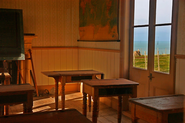
 Access to the school room was only as far as the foyer. There was good view out the window!


The school room


The stables
The Historic Places Trust has made a great job of restoration and ongoing maintenance as the photo inside the stables shows


Reflections in the stable window

Cattle still graze on the paddocks 175 years later.
Leaving Matanaka we stopped along the coast by the beach. High tide and a good swell saw the waves in action and coastal erosion below our feet! 

The bank is being steadily eroded with pieces falling in whilst
I took photos here.

After lunch at Shag Point, next stop was the lighthouse at Moeraki with the object of getting up close to some marine life in the reserve there.


The Moeraki or Katiki Point lighthouse first shone on 22 April 1878 and was automated in 1978. It overlooks a marine reserve where there are seals on the rocks below and plentiful seabirds of course. 


This seal was waiting for the next wave before plunging in.

Hanging on tight in the wind which ruffled the gull's feathers.

The reserve is also a very important nesting site for the hoiho, (Megadyptes antipodes) or Yellow-eyed penguin. I did see one hoiho but it was too far away to get a photo which was good enough to publish here. Time was short and I didn't have time to wait until they were coming back home from a day out fishing.


An earlier trip to Moeraki saw the following traditional shots taken of the boulders on a bright sunny day.


The weekend trip saw us arrive at the boulders around an hour before sunset. A chance to experiment with an ND stopper. The shot below had a 10s exposure.
A variable density ND filter allowed this shot at ISO-100 and f/9 to give a good depth of focus.
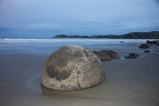
The Moeraki boulders are one of New Zealand's must spots. As I don't like taking photos with people in them, if possible, patience is a virtue. I had to wait some time before the posers had finished and there was a gap before the next lot crawled into this one.

Septarian concretion
These boulders were formed around 56-66 million years ago. they are composed of mud, fine silt and clay cemented together with calcite and are around 1 metre in diameter. 
Shot details: ISO-100, 4s at f/6.3, Night portrait  setting


Nearly sunset
As the sun dipped below the horizon it was time to get the tripods set up and start experimenting with exposures to get the best shots of burning steel wool. Some of the results are below. 


Shot details: 10s, at f/6.3. ISO-100.


More photos and details of how we got these photos can be found here.

Day 2