
We recently spent a weekend down at Moeraki with the photography
club, Focus Aorangi from Timaru.
The weather forecast was for strong SW gales and snow down to 100m
in Southland and Otago. The snow didn’t eventuate but the gales coming up from
the deep south certainly did. The gales were to have an impact over exposed
parts of the country and which kept a keen bunch of photographers enthralled as
will be seen later.
On the way down we called into Kakanui where we first met the
force of the wind. The huge swells had stirred up the sea so that it was brown
with all the sand disturbed by the high energy impact of waves crashing onto
the shore.
 |
| Cold and uninviting. Kakanui from the north side. |
It was an early start on Saturday to catch the sunrise. At this
time of the year the first hint of dawn was around 0730 hrs.


After breakfast we headed off down through Palmerston to Waikouaiti
and the farm at Matanaka.
This farm was set up by Johnny Jones, an Australian who set up a
whaling station nearby in 1838. When the whaling decreased he purchased nearby
land and built farm buildings in 1840.
The five
buildings are the oldest surviving farm buildings that are still in their
original position in the country. The farm is owned and administered by the New Zealand Historic Places
Trust, and the
buildings are registered as Category I and are considered "historically
outstanding".
 |
| Matanaka Farm buildings - built 1840 |

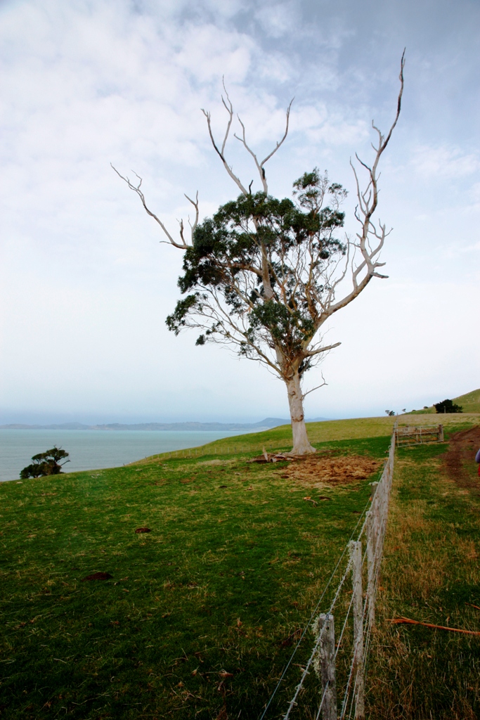 |
| The old gum on a commanding coastal position |
 |
| From left: Implement shed, latrine, school room |
Johnny Jones supplied the early settlers in Dunedin with fresh meat and vegetables using small boats as transport. Inside the implement shed there is an example of one such boat made of local materials and sail cloth.


 |
| The school room |
 |
| The stables |
The Historic Places Trust has made a great job of restoration and ongoing maintenance as the photo inside the stables shows

 |
| Reflections in the stable window |
 |
| Cattle still graze on the paddocks 175 years later. |
Leaving Matanaka we stopped along the coast by the beach. High tide and a good swell saw the waves in action and coastal erosion below our feet!
 |
| The bank is being steadily eroded with pieces falling in whilst I took photos here. |
After lunch at
Shag Point, next stop was the lighthouse at Moeraki with the object of getting
up close to some marine life in the reserve there.

The Moeraki or Katiki Point lighthouse first shone on 22 April 1878 and was automated in 1978. It overlooks a marine reserve where there are seals on the rocks below and plentiful seabirds of course.
The reserve is also a very important nesting site for the hoiho, (Megadyptes antipodes) or Yellow-eyed penguin. I did see one hoiho but it was too far away to get a photo which was good enough to publish here. Time was short and I didn't have time to wait until they were coming back home from a day out fishing.
An earlier trip to Moeraki saw the following traditional shots taken of the boulders on a bright sunny day.


The weekend trip saw us arrive at the boulders around an hour before sunset. A chance to experiment with an ND stopper. The shot below had a 10s exposure.

The Moeraki or Katiki Point lighthouse first shone on 22 April 1878 and was automated in 1978. It overlooks a marine reserve where there are seals on the rocks below and plentiful seabirds of course.
 |
| This seal was waiting for the next wave before plunging in. |
 |
| Hanging on tight in the wind which ruffled the gull's feathers. |
The reserve is also a very important nesting site for the hoiho, (Megadyptes antipodes) or Yellow-eyed penguin. I did see one hoiho but it was too far away to get a photo which was good enough to publish here. Time was short and I didn't have time to wait until they were coming back home from a day out fishing.
An earlier trip to Moeraki saw the following traditional shots taken of the boulders on a bright sunny day.


The weekend trip saw us arrive at the boulders around an hour before sunset. A chance to experiment with an ND stopper. The shot below had a 10s exposure.
 |
| A variable density ND filter allowed this shot at ISO-100 and f/9 to give a good depth of focus. |
 |
| Septarian concretion |
 |
| Shot details: ISO-100, 4s at f/6.3, Night portrait setting |
 |
| Nearly sunset |
 |
| Shot details: 10s, at f/6.3. ISO-100. |

More photos and details of how we got these photos can be found here.
Day 2


