Sunday, July 17, 2016

Lake Brunner - part 2

This is the second blog of our weekend at Lake Brunner with Focus Aorangi, the photographic club based in Timaru. Part 1 covers mainly lake and river scenes.

Between Moana and Stillwater is a road that leads down to the Arnold Power Station, (Stratford Rd) where a bush walk sets off to a view point overlooking the dam.

Arnold Dam
Along the way are some wonderful ferns, lichens and fungi. As I am no botanist, I have no idea of what species the following are but the photos are quite nice.


Around the other side of Lake Brunner at Mitchells there is a relatively easy walk up to the Carew Falls. Along the way there are lots of berries and fungi to stop and admire.

Carew Falls with a one metre granite boulder waiting to tumble down the river after a significant flood.
There is some interesting geology here in the above photo. If you look carefully above the boulder in the foreground, at 1 o'clock there is a grey streak of rock amongst the lighter coloured material. The grey rock is basement greywacke (sedimentary) which is older than the light coloured granite (plutonic igneous). Large intrusions of granite occurred along the western edge of the Alpine Fault, a classic example of such events.

The bush here contained large quantities of berries but I didn't see any birds feeding own them.


This fungal group was tucked away in the shade but with a tripod and tele- zoom lens it was a popular subject to photograph.


On the end of a fallen log, this fungus is contributing to its slow decomposition. 
On the way back from Mitchells and just outside Moana, opposite the old railway engine shed is a paddock of old mining gear slowly rusting away.

Locked gate barring entry.
As we did not have the unknown owner's permission, I could only get a few photos from the fence line.

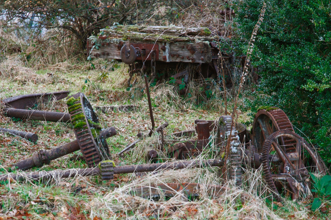
Part of a very old railway wagon was the start of a few wagon overgrown here.

Old winch parts


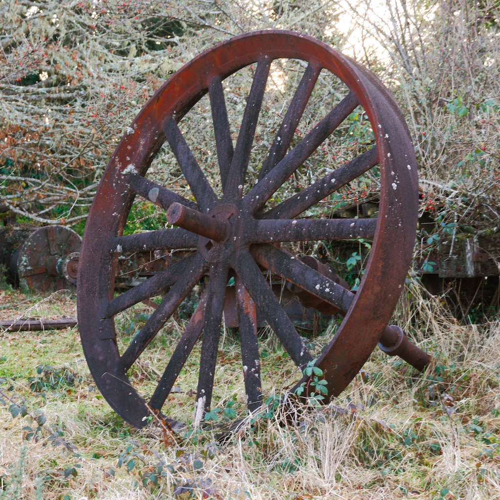
One can only guess what this was used for. Its survival is testament to the quality of steel manufactured in bygone times.
That concludes my selection of photographs from our weekend based at Lake Brunner for our annual, mainly photographic trip. Previous Focus Aorangi trips were to Mesopotamia and Moeraki.

We were in no hurry to get back home so spent a few days at Hanmer Springs with a side trip to Waiuta on the way.

Saturday, July 16, 2016

Waiuta

Going home from Lake Brunner we decided to head over the Lewis Pass via Reefton. On the way is the turnoff up the Blackwater Creek to the old gold mining town of Waiuta. I had been there about 30 years ago and was keen to see what is left of it now.

Gold was discovered in the headwaters of the Blackwater Creek on 9 November 1905, King Edwards VII’s birthday. The Birthday Reef as it was called began yielding gold in 1908 when the Blackwater Shaft came into commercial production. The town of Waiuta swelled to a maximum population of 601. (1936 census)

By 1938 a new shaft, the Prohibition was opened up and went down as far as 879m, well below sea-level. The Prohibition shaft taking over as the main entrance to the mine.

Decline started to occur in 1939 with the outbreak of WW2 as miners drifted away to join the armed services.

On 9 July 1951, the original Blackwater shaft collapsed. This was used for ventilation, pumping and electricity supply. Consequently, the mine began to flood and was abandoned. Waiuta quickly became a ghost town with numbers of buildings removed and relocated. Very little remains today.

More about Waiuta can be found here, including some of Joseph Divis’ photos. This site is well worth a diversion to.

Driving up towards Waiuta, the Blackwater School (1913 - 1949) comes into view.


Note the frost in the shadow behind the school.

There are attempts to restore the school and efforts so far in the room show what schools were like around 1949 when it closed.


Classroom, Blackwater School.


Lichen encrusted fencing
Heading up out of the valley towards the plateau at Waiuta, there is a very shady area where there was a good build up of frost.


Frost crystals
One of the first signs of former habitation, indeed maybe still occupied on occasions, is  a small red cottage at Waiuta.

A well preserved cottage, still owned and occupied by the
looks of the sign on the gate.

Blackwater mine engine room.
The fenced off area to the right contains the foundations of the machinery used to lower the cage into the mine shaft.
Blackwater shaft which collapsed in 1951
 Nearby are the remains which looks like a bank, judging by the large sturdy vault.


The old bank?
These above two relicts are all that remain here. There are massive concrete foundations nearby which housed the machinery for the mine. As the mine closed in 1951, my guess is that all the machinery was removed, for scrap or use elsewhere as there were huge shortages of steel after the end of WW2.

The old barber shop.

Overgrown gate

Joseph Divis’ house where he lived until the 1960s
This old house looks as though it had been one of the last to be occupied. The photo below was taken through a broken window.


Apart from some modern facilities for groups to stay, the photos above, apart from the Prohibition mine area, show about all there is to see here. Well worth a visit though, on a fine day.


Today, an extensive area around the Prohibition shaft is closed for the removal of large quantities of arsenic, left over from the removal of gold from the quartz veins.

Friday, July 15, 2016

Lake Brunner

I recently spent a weekend at Lake Brunner with Focus Aorangi, the photographic club based in Timaru, New Zealand. The weather was perfect after heavy frosts to start the days. The ultra calm weather lead to some awesome reflections in the both the lake and river.

Lake Brunner was gouged out by a branch of the Taramakau glacier during the last ice age. It is approximately 40 kmin area, 83m above sea level with a maximum depth over 100m. 

The lake was named after Thomas Brunner, who was the first European to see it in 1848. The lake’s Maori name, Moana kotuku “lake or sea of the white heron”, is used for the largest settlement on it shores.


The jetty at Moana.
We were fortunate in that the weather was fine after a heavy frost and the was not the slightest breathe of weird which produced some fantastic mirror like reflections.

The Arnold River flows out of the lake at Moana to join the Grey River. A swing bridge across the river leads to the Rakaitane Walk, an easy hour or so return journey.

Stunning reflections in the Arnold River.


Lake Brunner, from the swing bridge.

The Arnold river from the view point at the end of the Rakaitane track.

Shortly after the above photos where taken, peace was broken by an inconsiderate jet skier who destroyed not only only the silence, but the perfect reflections.

Reflections at sunset

A few km from Moana is Iveagh Bay.

Some expensive looking holiday homes at Iveagh Bay.

Reflections at Iveagh Bay.

Stumps at Iveagh Bay

Stumps at Iveagh Bay
Iveagh Bay sunset

On the other side of the lake is the former milling town of Mitchells. Apart from the lodge not much else is left there.


On the way to Mitchells

On the way to Mitchells
The track along the Bain Bay walk at Mitchells passes over swamps along the lake edge.

A small tributary to Lake Brunner at Bain Bay.
At the end of the track there is swamp beyond which you can not go any further. After a good frost, I found this flax bush on its own islet in the swamp with some ice remaining to its left. I like the great reflections here.

The tannin coloured water adds to the intensity
 of the blue sky reflection.

The next blog will feature the Carew Falls near Mitchells as well as some the features found in the bush.  Part 2